The Midland Cultural Centre wants to help bring the culture, stories, and science of Georgian Bay to a spotlight on the world stage.
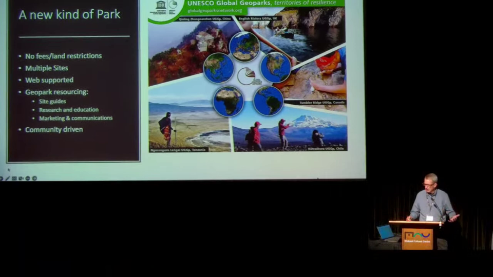
During a recent presentation held at Rotary Hall, members of the Georgian Bay GeoParks Network provided an inaugural audience with their pitch on how the region is a “slam dunk” in becoming a UNESCO Global GeoPark.
UNESCO (United Nations Educational, Scientific and Cultural Organization) is a 1945 post-war organization dedicated to sustainable development goals resulting in peace through international cooperation.
A GeoPark is a unified geographic area where sites and landscapes of geological significance are managed through conservation and local communities to promote protection, education, and sustainable development. There are currently five Global GeoParks within Canada, with a total of 177 across 46 countries worldwide.
Tony Pigott hosted the event and fielded questions following the 60-minute presentation, following an introductory drum circle by the Chigamik CHC and prayer from Gwen Lindsay of the Georgian Bay Métis Council.
“GeoParks are not conventional parks as you might think of them,” Pigott began.
To help explain the significance of the scientific aspect, geology professor Nick Eyles from the University of Toronto provided the reasoning why rocks are full of history.
“The bottom line is (geologists are) big storytellers,” said Eyles. “If you travel around the world, you’ll find there are places that tell the story about the evolution of the planet, and it’s about 4.5 billion years old. Georgian Bay is one of those places that tells a lot of stories because we have 2.5 billion years of Earth history preserved on our doorstep.
“We have more than half of the Earth’s evolution recorded in a pretty small place. Close to major cities, close to communities; it’s accessible.”
Over 100 geosites have been proposed in waters and lands surrounding the hundreds of kilometres of Georgian Bay, and through the informative Georgian Bay GeoPark website those stories can be experienced, with examples given of the Parry Sound shear zone, the banded gneiss on Bartram Island, and many more.
Storytelling was a major focus of the initiative, with special importance given to the tales passed down from the generations of Indigenous and Métis in the area. Jack Contin provided the audience with an overview of why 11,000 years of human history and culture was so important for the project.
“I think it’s so important that we make these legends and stories come alive, and I think this is what will happen when we develop the GeoPark sites,” said Contin, including the instant information digital component.
“It’s a great opportunity for the Indigenous people to tell their story. It’s a right step when we do land acknowledgment to understand that it is a way to reconcile, and a way to bring health to ourselves, but to the health of the land that’s the most important part in the protection in our water… particularly Georgian Bay.
“The global world will see this as we develop the GeoPark, and I’m really honoured to be a part of this,” Contin added.
An interactive map for Let’s Rock Ontario provided by the University of Toronto was on display at the event, showcasing many of the province’s landmarks and sites through story map trips and virtual reality tours.
Additionally, eight detailed ‘virtual field trips’ were created for the GeoPark website to allow visitors a glimpse at what could be presented for any of the geosites in the region.
Postdoctoral fellow Kirsten Kennedy of the University of Toronto explained how technology would enhance an understanding of Georgian Bay.
“One of the really important roles of a GeoPark is in creating educational content that we can put into schools and share with the public,” stated Kennedy.
As part of her research, and with the assistance of a $60,000 Mitacs grant and matching $60,000 from the Georgian Bay Land Trust and other community individuals, cutting-edge drone mapping using LiDAR technology will be conducted around Georgian Bay.
Said Pigott, “The Georgian Bay GeoPark web platform and social media are going to be the true engine and enabler for the GeoPark to come alive, and to bring it alive for many people who may never even come to Georgian Bay.”
During questions from the audience, one voice summed up the event to the approval of the gathering.
“It seems to me that this is an initiative to bring different groups together – cultural groups, scientists – so that an increased love for the space is brought forward, and then the citizens will work with that according to how we work in the geopark. So we have to stand up and take our place in this.”
The comment received applause, with Pigott stating, “Well put.”
Following the presentation, Kennedy responded by email to questions from ***MidlandToday*** regarding the research involved and the educational component.
“The Mitacs grant, which includes contributions from the community, is instrumental to my research - I couldn't do anything without it,” noted Kennedy.
For the technical aspect, she responded, “LiDAR has completely revolutionized many branches of geoscience, including the study of glacial landforms. My particular research uses drone-mounted LiDAR to survey small areas at very high resolutions. I use the data collected in flight to create a model of the ground surface in ArcGIS.”
“Currently, the educational materials are geared towards university students with no specific geologic background, but this is just the beginning of this project. We hope to develop more for K-12 schools as we progress.
“Much of what we do will be driven by engagement within the communities, so if we get a lot of interest, and maybe partnerships from different groups, then we can explore making more offerings,” Kennedy concluded.
An archive of the presentation is available on YouTube through the Midland Cultural Centre channel.
