WEATHER ALERTS
ENVIRONMENT CANADA
**************************************
Weather advisory issued for:
• Midland - Coldwater - Orr Lake
• Orillia - Lagoon City - Washago
• Barrie - Collingwood - Hillsdale
Current details:
Winter weather travel advisory in effect.
This winter weather travel advisory has been upgraded from a Special Weather Statement that was previously in effect.
What:
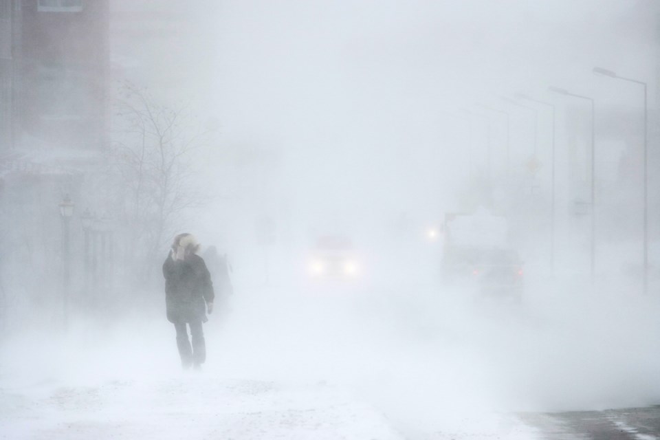
Significantly reduced visibility in snow and blowing snow.
Snowfall accumulations up to 10 cm by Tuesday morning.
Southwesterly wind gusts up to 70 or 80 km/h.
When:
Through early Tuesday morning.
Additional information:
\Southwesterly winds will continue to strengthen this afternoon. Conditions will deteriorate this evening as flurries intensify in advance of a strong cold front. Strong wind gusts in combination with heavy flurries will result in reduced visibility in snow and blowing snow. Late this evening, as a sharp cold front moves through, near zero visibility in bursts of heavy snow and blowing snow are possible along with a sharp temperature drop. A frontal snow squall warning may be required.
Motorists should expect hazardous winter driving conditions and adjust travel plans accordingly. Visibility will be suddenly reduced to near zero at times in heavy snow and blowing snow.
Be prepared to adjust your driving with changing road conditions. If visibility is reduced while driving, slow down, watch for tail lights ahead and be prepared to stop.
For road conditions and other traveller information from the Ministry of Transportation, visit https://www.ontario.ca/511, https://www.twitter.com/511Ontario, or call 5-1-1.
Please continue to monitor alerts and forecasts issued by Environment Canada. To report severe weather, send an email to [email protected] or tweet reports using #ONStorm
**************************************
Snow squall warning issued for:
• Owen Sound - Blue Mountains - Northern Grey County
Current details:
Snow squalls expected beginning later today.
What:
Sudden near zero visibility due to heavy snow and blowing snow.
Snowfall accumulations of 10 to 20 cm through Tuesday morning.
When:
Beginning late this afternoon or early this evening and continuing into Tuesday morning.
Additional information: Southwesterly winds will intensify this morning. Conditions will deteriorate late this afternoon into this evening as flurries become heavy at times in advance of a strong cold front. Strong wind gusts in combination with heavy flurries will result in significantly reduced visibility. Conditions may be particularly dangerous as a sharp cold front moves through this evening which could produce near zero visibility in bursts of heavy snow and blowing snow along with a sharp temperature drop. Winds will gradually decrease through tonight.
As winds become northwesterly in the wake of the cold front, lake effect snow will develop off Lake Huron and Georgian Bay overnight before weakening in intensity late Tuesday morning or early Tuesday afternoon.
For information on strong winds, please see the wind warning and special weather statement that are currently in effect.
Visibility will be suddenly reduced to near zero at times in heavy snow and blowing snow. Road closures are possible.
Prepare for quickly changing and deteriorating travel conditions.
**************************************